RAILWAYS · HIGHWAYS · INFRASTRUCTURE
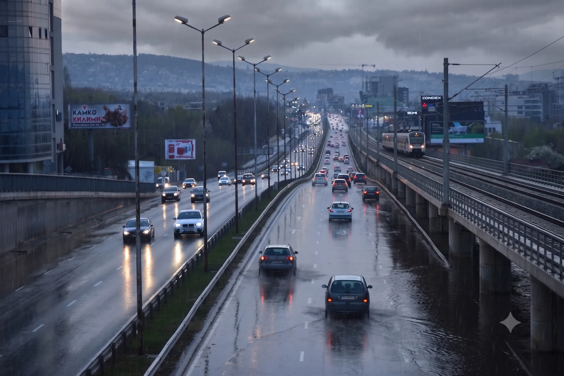
A weather-driven stoppage is not a rare event. It's routine.
Anticipate landslides, fog and extreme rain before they turn into surprises. Resolution per slope, tunnel and kilometer.
+10,000 actionable alerts per year applied to real decisions


When the weather catches you off guard, your business pays
R$ 3 billion
in losses on highways and bridges in Rio Grande do Sul after the 2024 floods.
R$ 250k/h
in cost per hour stopped. 3 shutdowns in 4 months on railways in Brazil.
6 of 10
leading causes of accidents on federal highways stem from low visibility.
In every one of these cases, the event arrived before the decision.
The decision before the event. Down to the kilometer.

A view per kilometer, not per region
1 km to 3 km resolution, point by point. The control center doesn't get "rain in São Paulo". It gets "slope T-14 at km 223, 87% probability of closure in the next 6 h".
- Hyperlocal
- Per asset
- 1 km to 3 km resolution

Closure risk, not a rain forecast
Every alert translates wind, rain, fog and landslide into the risk of halting the segment. The team receives the risk level, the likely window and the recommended action.
- Operational risk
- Safe windows
- Probabilistic

Straight into the control center, no interpretation along the way
Integration via API, WhatsApp, SMS, email and Teams. The person in charge doesn't get a generic message. They get an action to execute before the event.
- API
- Teams
- Manuals by alert level
The next stoppage costs more than anticipating it.
You can't control the weather, but you must manage the risks
Railway and highway operator
When the warning comes first, the control center gains time.
+8h
of lead time before critical events.
Before i4sea, stoppage and reopening decisions were made within minutes-long windows. With hyperlocal alerts per segment, the control center began operating with hours of lead time. This reduces derailment risks, improves preventive maintenance and increases safety.
Questions we hear before every decision
The next stoppage costs more than anticipating it.
You can't control the weather, but you must manage the risks
Each at-risk slope is registered as a monitored asset, with coordinates, geometry and history. The model combines accumulated rainfall, soil type, slope gradient and operational triggers to generate dedicated alerts for that slope.
Yes. Each kilometer has its own rules and levels. You define what's critical, such as slope T-14, tunnel T-3 or the bridge over the Tietê, and receive individual alerts per asset, not per region.
It depends on the phenomenon:
- Severe storms / gusts: 1–6 h
- Accumulated rain / soil saturation: 24–72 h
- Cold fronts, heat waves, surges: 3–7 days
- Nowcasting (incoming rain): 15 min–2 h
Yes. We deliver alerts via REST API, WhatsApp, Teams, SMS and email. For legacy systems (SCADA, Maximo, ServiceNow), we configure custom webhooks during onboarding.
4 weeks, in 4 stages:
- Mapping of critical assets (km, slopes, bridges, tunnels)
- Calibration with the client's event history
- Configuration of alert levels, channels and recipients
- Training of the control center with protocol activation by alert level.
Yes. That's exactly where we add the most value. We don't depend on ground stations. We combine a numerical model, 10 years of proprietary reanalysis and AI models to generate hyperlocal forecasts at any point.
We cross hyperlocal forecasting × the segment's history × the client's operational thresholds. The result is calibrated probability per asset: "T-14 has an 87% chance of closure in 6 h if accumulated rain exceeds 80 mm."
Heavy rain · accumulated rainfall and soil saturation · wind and gusts · fog and low visibility · lightning · severe storms · hail · heat and cold waves · surge (on coastal segments).